Importing non-georeferenced map
When you have jpg or png maps which are not georeferenced and this needs to be done manually. There are two ways of doing this.
1. World of O
Visit http://omaps.worldofo.com/gps/ and follow the instructions.
2. Google Earth
You will need to install Google Earth.
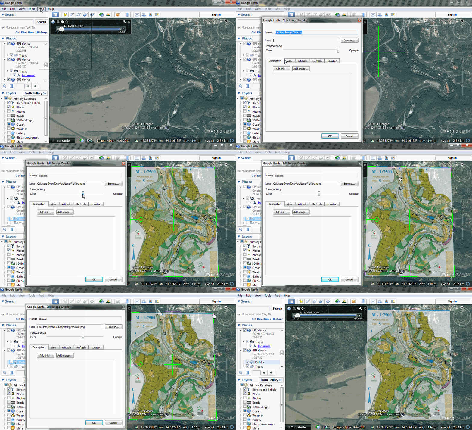
You open Google Earth and select Add->Image Overlay You select the image of the map from our HDD. In this example kailaka.png
You will see the map placed on the earth surface. Now you can adjust the transparency so we can match the map with the terrain. You use the green outline to adjust and move the map. When you are sure that the map is adjusted correctly you can click OK.
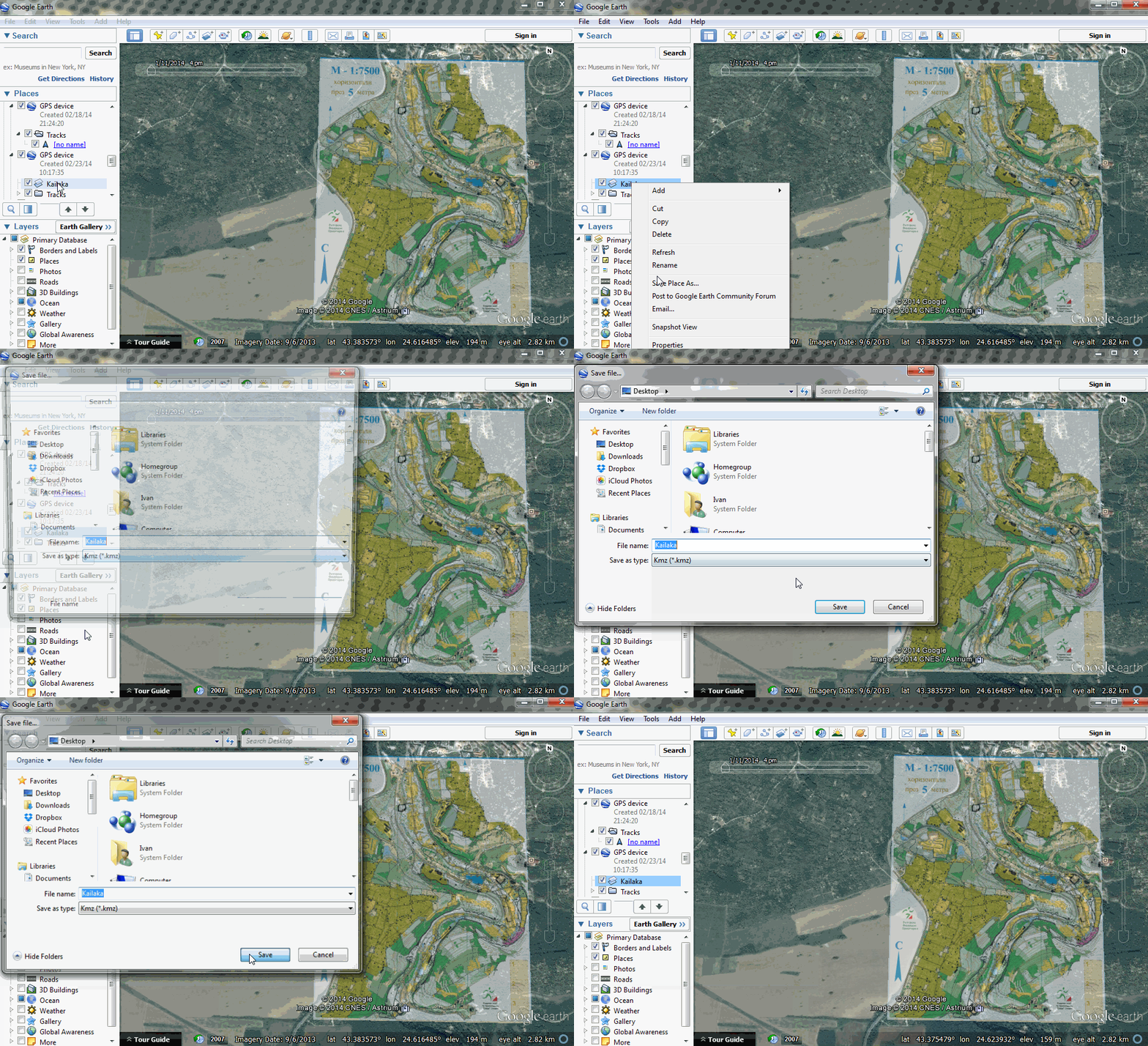
In the menu on the left we right-click the map we just added and select Save Place As... In the Save As window you select kmz from the Save as type dropdown and Save the file.
From then on you can Upload the kmz to Loggator as in the last part of Importing Maps from OCAD

